Showing posts with label Stuart Highway. Show all posts

Sunday, July 20, 2025

Day 1 – Alice Springs to Wallaby Gap Campsite (Section 1 Larapinta)

 Up at 5:30am for showers , breakfast and pack up. We dropped our bag of items we did not need for the hike at reception to store until our return.


We left The Diplomat Hotel at 6:50 am and walked alongside the Todd River to the start of the Larapinta Trail at Alice Springs Telegraph Station. We did not stop to explore the Telegraph Station as we have done this previously (see 21 July 2016). Here we encountered a group of hikers from our flight yesterday who were also about to start the hike, as a fundraiser for The Cancer Council. 

https://diplomatalicesprings.com.au/

https://nt.gov.au/parks/find-a-park/tjoritja-west-macdonnell-national-park/larapinta-trail

https://nt.gov.au/_media/docs/parks/bushwalking-and-hiking/larapinta-trail/larapinta-trail-section-1-information-sheet-and-map.pdf

https://alicespringstelegraphstation.com.au/

https://www.cancer.org.au/


Today we saw a lot of people on the trail. The views changed rapidly as we progressed along the trail. The trail loops around and goes under the Stuart Highway north of Alice Springs. Between the Geoff Moss Bridge and the railway line we saw the Ghan pass along the railway track.  Further along the Larapinta Trail cross the railway tracks with a simple warning to “look for trains”. 

https://www.journeybeyondrail.com.au/journeys/the-ghan/


The trail then rises giving views in which the road trains on the Stuart Highway appear like matchbox vehicles. We saw several Australian Ringneck Parrots, also known as Port Lincoln Parrot (Barnardius zonarius).

Courtesy of the good rains earlier in the season (Alice Springs had flooding) there was an abundance of wildflowers in bloom. We crossed several dry creek beds, before beginning the climb to Euro Ridge. The climb has a lot of ascent and descent with a false crest and amazing views. We stopped here for lunch while taking in the big open spaces. Parts of the trail here are quite close to the edge of the ridge and not for those fearful of heights.


We arrived at Wallaby Gap campsite about 2:45pm. We set up camp, filled our water bladders for tomorrow and had our electrolytes by 3:20pm. The flies were much worse in the campsite than while walking.  The campsite has a shelter, water tanks, pit toilet and several table/platforms in the open, with space for plenty of tents.

We took an afternoon walk to Wallaby Gap, there was water present, but it did not look drinkable. The rocks had an interesting white growth or deposit on them; possibly some sort of mineral salt deposited from the water??.  


I knew the ground would be hard but nonetheless the soles of my feet were very sore from today’s hike. The rocks on solid rock do not give at all when walked on and all the impact goes into the foot. I was glad to take my boots off and switch to my Crocs for the evening.

At around 4:30pm the temperature rapidly fell. Not a lot of sleep was had due to a very noisy snorer in camp.

Statistics

Hike Distance         18.97km

Hike Time                 6h 17m

Ascent                       514.2m

Descent                     443.0m

Walk Distance         0.46km

Walk Time                0h 29m

Ascent                       5.4m

Descent                     3.3m

Friday, August 16, 2024

Darwin to Katherine - Jatbula Trip


Pre Day 1 – Friday 16 August

Darwin to Katherine

We woke about 6:30am and had showers and breakfast.  Once reception opened, we checked out and headed to BCF Yarrawonga (to be there when the opened at 8:30am) to purchase our gas and insect repellent for the hike.

https://www.bcf.com.au/stores/details/bcf-palmerston

South down the Stuart Highway to Katherine.  There is something special about the bush in the Top End.  The Kapok trees were in bloom with very few leaves left on the trees.

https://en.wikipedia.org/wiki/Stuart_Highway

https://www.visitkatherine.com.au/

https://northernterritory.com/katherine-and-surrounds


Things we saw on the road that remind us we are in the Top End: 

  • 130km/h speed signs
  • Road trains with 4 trailers. We saw one road train that was transporting three demountable houses at once
  • Metal power poles – the termites are too active for anything else to last

We arrived in Katherine in time for lunch, which we enjoyed at the local Coffee Club. We then headed to Riverview Tourist Park and set up our tent in an unpowered site.  We filled the water bladders in our packs and organised the food needed to the first day of our walk to be accessible. 


We filled the car with petrol, which proved a little tricky as the instructions provided on how to open the cap for the petrol tank turned out to be for a different vehicle.   

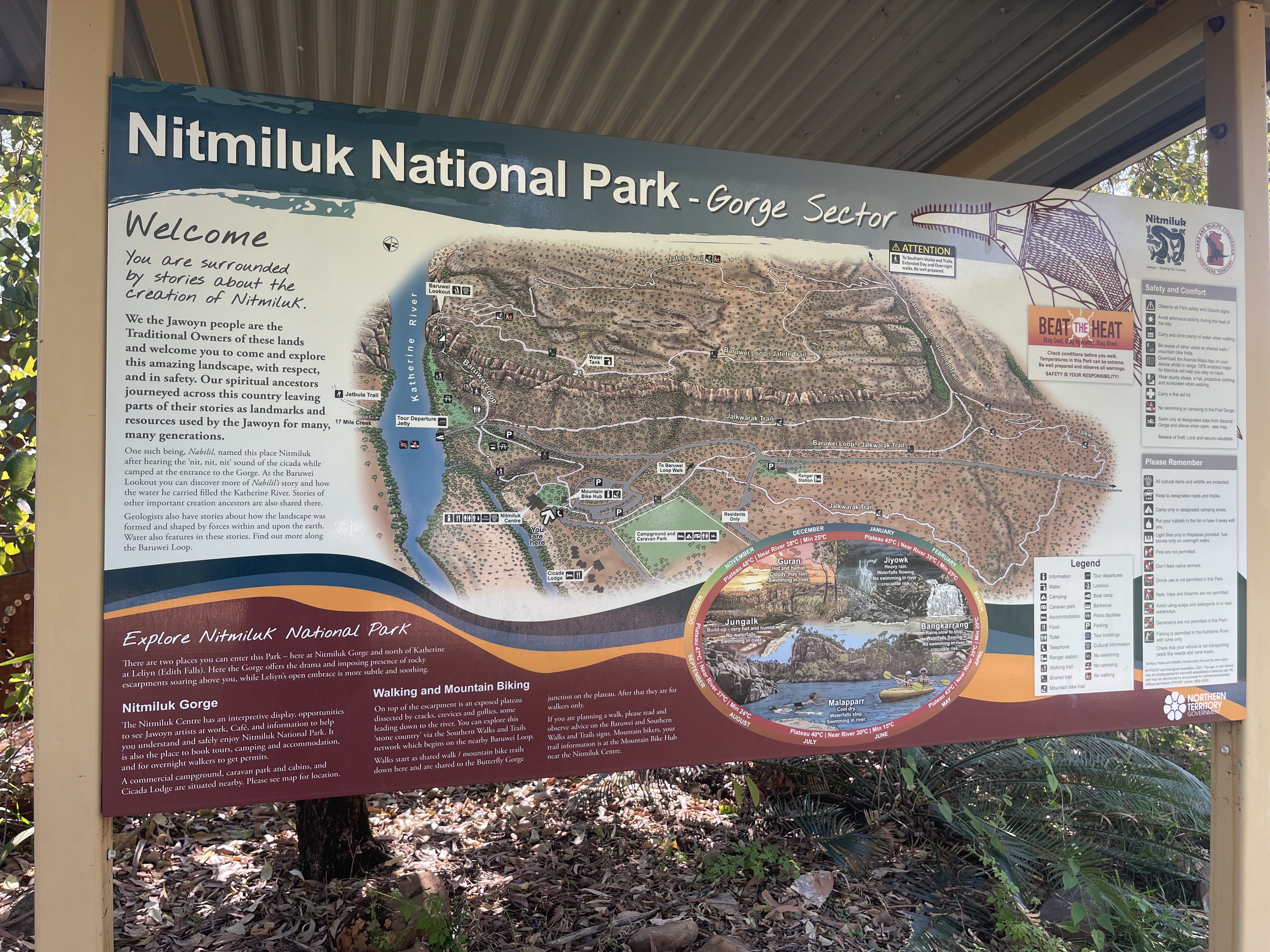
Then off to Nitmiluk Visitor Centre for our 3pm Safety Briefing and to have our permits signed to be able to board the ferry in the morning.  We met some of our fellow hikers, who would all be going on the 7am ferry the next morning.  Two young men in their early 20’s, and three brothers in their mid to late 20’s.  After the briefing we walked over to where the ferry would go the next morning to be sure we knew exactly where we would be going as we knew we would be pushed for time in the morning.

https://www.nitmiluktours.com.au/about/visitor-centre/

https://nt.gov.au/parks/find-a-park/nitmiluk-national-park/nitmiluk-national-park-jatbula-trail#:~:text=Safety%20briefings%20take%20place%20at,you%20can%20attend%20either%20session.


We then drove back to Katherine and had a relax in the crystal-clear Katherine Hot Springs before dinner and an early night.  The Katherine Hot Springs are a short walk via a gate at the back of the caravan park.

https://northernterritory.com/katherine-and-surrounds/see-and-do/katherine-hot-springs