Tuesday, December 28, 2021

Sunshine Coast Hinterland Great Walk (Day 3 of 3)


https://parks.des.qld.gov.au/parks/great-walks-sunshine-coast

This morning it was pouring with rain. I managed to take a few photographs of the creek in a break in the rain while we ate breakfast.  Unfortunately, we had no choice but to pack up in the rain and accept that the tent would be wet and heavy.  


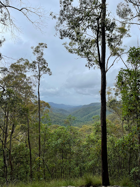
After packing up, we headed off to begin the ascent of Gheerulla Bluff.  This is generally very hot when we have done it in the past. Today was different because we were much earlier in the day and there was cloud cover with drizzle to rain as we climbed.  The rain brought out some beautiful colours in the bark of the various trees, as well as having washed all the foliage clean.  As always the view from about two thirds of the way up was beautiful - I am sure the chance to catch my breathe helps too!


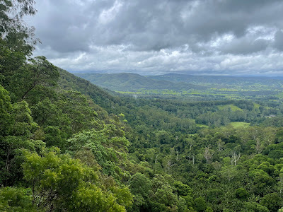
Once at the top of the Bluff it is a very pleasant walk along the top. We stopped at Thilba Thalba Viewpoint. The view of the valley showed the clouds forming between the ridge lines.

Continuing along the ridge line we came to Thilba Thalba Walkers Camp.  I have long wanted to camp here as it is such a pretty spot.  Today however there was a lot of wind and rain and the idea of spending the afternoon here was not relaxing.  I will plan to come back another time in better weather and camp here.


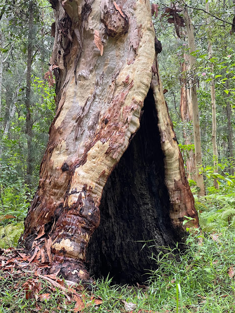
Once again I was surprised at the rapid change in microclimates along this ridgeline as evidenced by the changes in flora.  


After reaching Delicia Road at the entrance for Gheerulla Falls we followed the road back to Mapleton to our car.


Today's statistics were 20.1km, 6h 33min (not including lunch stop), total ascent 752m, total descent 490m

Statistics for the three days 60.0km, 20h 20min, total ascent 2084m, total descent 1935m


Monday, December 27, 2021

Sunshine Coast Hinterland Great Walk (Day 2 of 3)


https://parks.des.qld.gov.au/parks/great-walks-sunshine-coast 
After packing down camp, we walked on toward Baxter Falls. Again the rainforest was very green, wet and lush with plenty of water in the creeks.


Baxter Falls, like all the waterfalls, had plenty of water flowing through it.


From here, we continued across the suspension bridge and on towards Mapleton.  After a solid climb, the walk rejoins the road, travelling through the outskirts of Mapleton.


Mapleton Falls lookout provides a view of the falls, but to me the view over the valley and edge of the escarpment is the winner.


At the day use area we stopped for morning tea.  It was great to see lots of families out and about here.
Then we continued on toward Ubajee Walkers Camp. 
As it was only 12:30 when we got here and it was raining, we decided to go on to the next section of the walk.


Ubajee Viewpoint gives picturesque views out over the valley.
We then continued on down the switchbacks to the bottom.


Turning left we walked through to Gheerulla Falls, doing a bit of rockhopping to get across the creek.

We then backtracked to the junction and continued along Gheerulla Creek to Gheerulla Camping Area. There are several creek crossings on this and there was plenty of water around.


We had a swim in the creek on arrival and changed into our dry clothes for the night.  Quite suddenly the sky went dark and before we could get the tent up the skies opened.  End result - water in the tent and damp clothes for the night.

Statistics for the day: distance 22.2km, time (minus morning tea and lunch stops) 7h30min, total ascent 565m, total descent 881m