Showing posts with label cemetery. Show all posts

Saturday, February 24, 2024

Ryans Den Campground to Devils Kitchen Campground (GOW Trip)

 24 February 2024 (Day 7) 14-22 degrees

 https://www.parks.vic.gov.au/places-to-see/parks/great-otway-national-park/things-to-do/great-ocean-walk

https://www.greatoceanwalk.info/

https://www.thegreatoceanwalk.com/official-sections/

It was a cool night, but better once the wind dropped a little. On waking the wind was noticeably less than yesterday. Over breakfast Drew spotted a koala with baby in a nearby tree. This is the only campsite so far that has had no blue fairy wrens.

 https://www.greatoceanwalk.info/day-6-ryans-den-to-devils-kitchen/

Very hilly start to the day, constantly up or down with very little flat. We saw a few swamp wallabies. The track would be very slippery and gluggy in wet conditions. There were a few small areas not far into today’s walk where the grass was a little overgrown (these were the first such spots we had encountered on this walk).


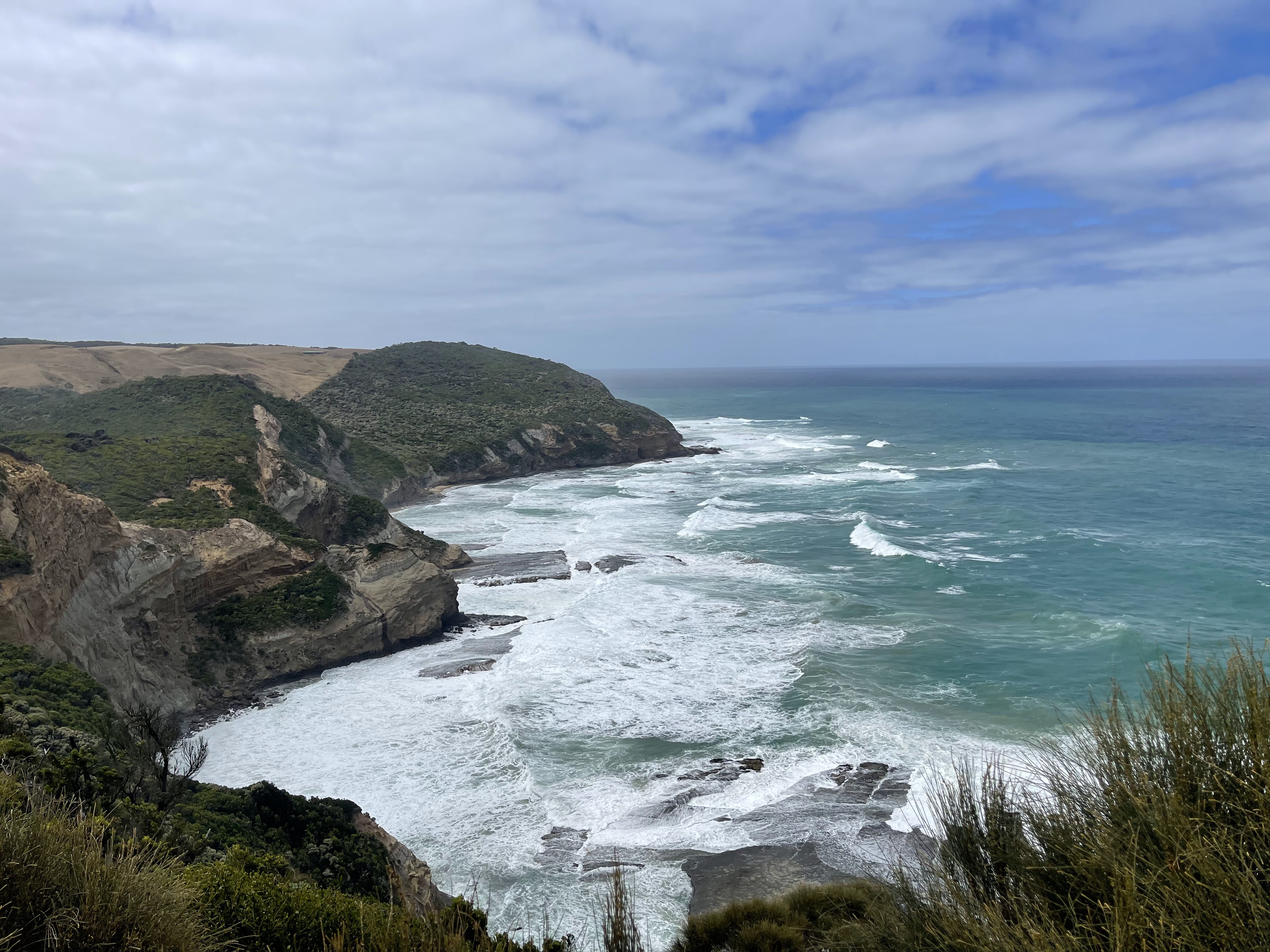
The second section of walk had much gentler inclines and declines and passed through lovely woodland. We took a side trip to Moonlight Head Cemetery. The view from Gables Lookout was good – the ocean was still fairly calm but I certainly would not like to be in it. We saw flocks of Gang-gang Cockatoos.


At the eastern end of Wreck Beach we felt there was too much water for us to go down and hike to Devils Kitchen this way.  We continued on the inland route, which was very pretty. National Parks have done a lot to protect grass trees and other native plants from cinnamon fungus; there are functional boot cleaning stations and more than a kilometre of raised walking track.


The view from the top of the campsite was beautiful and being first into camp we were lucky enough to snag the top campsite.

 https://www.parks.vic.gov.au/places-to-see/sites/great-ocean-walk---devils-kitchen-hike-in-campsites


In the afternoon we took the walk down to Wreck Beach to see the anchors and anchor chain winch. We were down here on an outgoing tide with calm seas and the waves still occasionally touched the base of the cliffs - it would be totally terrifying to be wrecked here. We then took a side route up top to the burial site for some of the seamen from the Fiji wreck. Some of last night's campers arrived, having walked via Wreck Beach – their opinion, we made the correct choice in dropping off our packs and heading down later from this end.

https://www.visitmelbourne.com/regions/great-ocean-road/see-and-do/outdoor-and-adventure/walking-and-hiking/vv-wreck-beach-walk 

https://www.parks.vic.gov.au/news/2022/07/27/00/16/historic-shipwreck-coast-monument-accessible-again


 The evening concluded with a nice sunset from the lookout.


Statistics

Distance    15.46km

Time         5 hours

Ascent      500m

Descent     511m

Temperature 14.1 – 22.0 degrees Celsius


 Trip to Wreck Beach and Fiji Memorial (without packs)

Distance     5.57km

Time         2 hours 6 minutes

Ascent      215m

Descent     211m


Tuesday, February 20, 2024

Blanket Bay Campground to Cape Otway Campground (GOW Trip)

 20 February 2024 (Day 3) 16-22 degrees

 https://www.parks.vic.gov.au/places-to-see/parks/great-otway-national-park/things-to-do/great-ocean-walk

https://www.greatoceanwalk.info/

https://www.thegreatoceanwalk.com/official-sections/

Again during the night I woke to what sounded like heavy rain but was in fact wind and surf.

 https://www.greatoceanwalk.info/blanket-bay-to-parker-inlet-hike/

The walk to Parker Inlet was very sheltered with minimal breeze. The path at times is relatively close to the cliff edge, but with trees blocking the view (and fall). We saw two Swamp Wallabies – their tails look very strong and they are a very dark chocolate brown in colour.


 https://www.greatoceanwalk.info/parker-inlet-to-point-franklin/

Parker Inlet is very pretty with lots of kelp on the north-eastern side. The colour of the sand here is more like the colour we are accustomed to. We arrive at mid tide (outgoing) and the inlet was very easy to cross today. The path from here would be unpleasantly muddy in wet conditions. Coming from Parker inlet to Parker Hill Campground there were approximately 300m of upward stairs. The campground tank here was empty, but we had loaded enough water for the whole day.

https://www.parks.vic.gov.au/places-to-see/sites/parker-hill-campground 


We walked through bush for approximately 20 minutes before dropping down to the beach at Point Franklin, to see the Eric the Red anchor, and explore rock pools.  There were deep rock crevice that intermittently gave a whumping noise when the waves were just the right size. From here we decided to continue on the beach around Seal Point to Crayfish Bay, which was beautiful. We then climbed back up to the main GOW path. This was much hotter as despite being close to the cliff edge the trees trapped the humidity and blocked the wind. As we progressed along the walk we saw increasing glimpses of the lighthouse with lots of solid ups and downs. We continued past the lighthouse to the campsite and put up our tents before returning to the Cape Otway Lighthouse precinct to do a self-guided tour of the grounds. 


https://www.lightstation.com/

The lighthouse itself is currently off limits due to a previous earthquake and mercury spill. There were several buildings to explore, including bunkers that were used for communications during WW2. We enjoyed a muffin and caramel slice at the cafĂ©, which is located in one of the heritage buildings. Life at the lighthouse would have been a very isolated existence. 

https://www.lightstation.com/explore-cape-otway/cafe/


Old and New
On our return we continued past the campground to look at the small Cemetery associated with the lighthouse community.

https://www.visitmelbourne.com/regions/great-ocean-road/see-and-do/outdoor-and-adventure/walking-and-hiking/vv-lighthouse-cemetery-and-lookout-walk

 https://www.findagrave.com/cemetery/2363591/cape-otway-cemetery

In camp tonight we had last night's group of teens and another group from the same school, as well as a new and quite different group. The map of the Cape Otway Campground does not fit the current layout of the campground.  There have been some upgrades here with the camp shelter area having LED lighting and USB charging points.


Statistics

Distance    12.09km

Time         4 hours 45 minutes

Ascent      377m

Descent     302m

Temperatures 16.3 – 22.1 degrees Celcius